
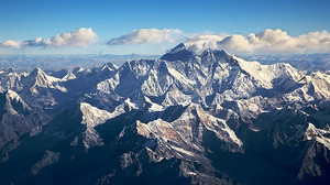
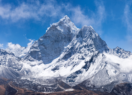
MountainsChina has several mountain ranges. Himalayas are the tallest mountain ranges in the world. They stand at the boarder of Tibet and Nepal. mount everest is the tallest mountain in the world it stands 29,029' feet. sherpa's live in the mountain range in the Himalayan mountain range
|
|
|
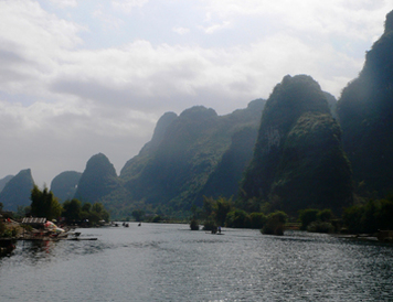
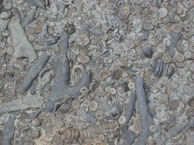
Karst mountains are other mountain ranges in China. Karst mountains are found in south China. These moutons rises from flat ground. They are made out of limestone because they were once were at the bottom of the ocean. Limestone is made from shells skeletons of marine animals.
|
|
Rivers
China has three main rivers the Yellow river the Yangtze river and the Pearl river
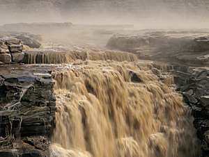
The Yellow River (Huang He) is the second longest river in China. The Yellow River appears yellow because large amounts of yellow loess sediment silt turns the water yellow. It also is called "the cradle of Chinese civilization" because its basin is the birthplace of ancient Chinese civilization. The Yellow River is prone to flooding.
|
The Pearl River is in Southern China and empties into the South China Sea. The Pearl River is China's third longest river. The Pearl River gets its name from all the pearl colored shells at its bottom.
|
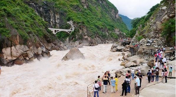
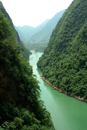
The Yangtze River is China's longest river. It is 3,915 miles long. The Yangtze originates on the plateau of Tibet in the far West and empties into the East China Sea. The river valley is the source of much of China's crops especially rice, cotton, barley, wheat and corn. Tiger Leaping Gorge in the Yunnan Province is one of the Yangtze's very deep canyons. The river is so deep and rough that it is not navigable there. There is a legend that a tiger leapt across the gorge, 33 yards, to escape from hunters.
Deserts and Plains
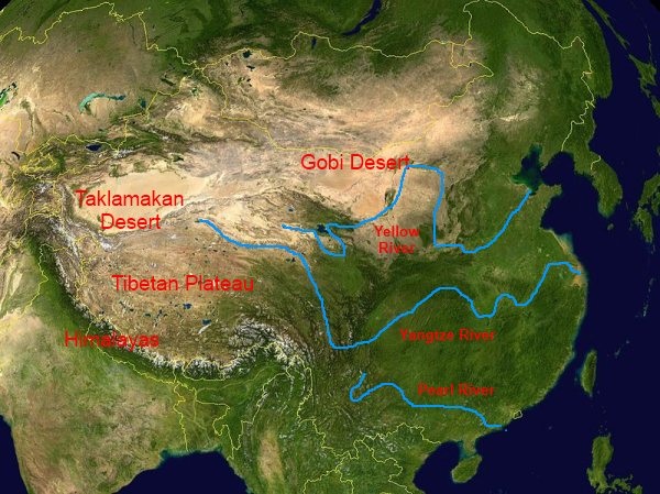
China's terrain includes deserts and plains in addition to its mountains and rivers. The Himilayan mountains in the West create a "rain shadow" which is where the mountains block rainy weather from forming. Taklamakan Desert is on the other side of Tibet. The Gobi Desert is the 5th largest desert in the world. And is the coldest. It is located in the North of China between China and Mongolia. There are also plains in China. The Yellow River's alluvial plain is one of the rich growing plains in China.
